Cavendish Philatelic Auctions Ltd. Sale: 828
|
Great Britain and British Commonwealth
WILTSHIRE | |||||
 Sale No: 828
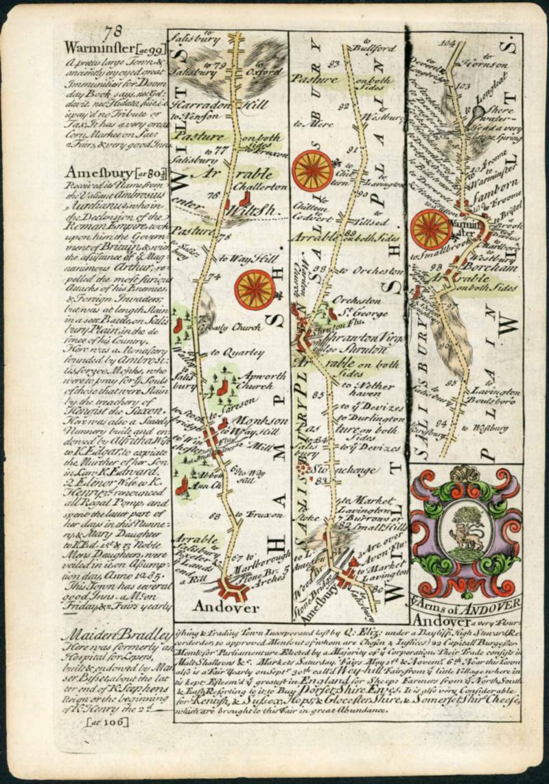
Lot No:1876 Symbol: Cat No:Collection THE WILTSHIRE ROAD-MAPS, TOWN MAPS, MOON-RAKER POSTCARDS, ETC.; 1731-1844 group of mainly very fine and hand-coloured maps inc. 1731 Owen & Bowen pair (Marlborough/Calne & Amesbury/Warminster), 1808 Edward Mogg Warminster strip-map, 1832 album-page size Dawson early town-maps pair (Wilton/Malmesbury + Chippenham/Calne), foolscap c.1831 hand-coloured Wilton boundary map (with Govt. report pages; usual folds), 1837 Lewis quad-maps page of Salisbury/Devizes/Marlbro'/Westbury, fine page-size 1844 Frustfield Hundred map, Bacon's county map/guide for cyclists, and a group of PPCs of the Moonrakers etc. (33 items) Cross Reference: MAPS, PICTURE POSTCARDS (Image)
|
|||||
|
|
|